Reviewing the First Phase Studies and Conducting the Second Phase Studies of Training of the Cheshmeh Kileh, Azarod, Kazemrod and Chalakrod Rivers in Western Regions of Mazandaran
Introduction
Considering the nature of the rivers of Mazandaran province in terms of severe morphological changes, high erosion, flood potential, encroachments on the riverbed and river boundaries, and the poor condition of the rivers, studies of the comprehensive engineering plan for the rivers of Mazandaran have been carried out with the approach of the above objectives. In this regard, studies have been carried out to determine the limits of the riverbed and river boundaries, identify vulnerable points that require river training, problems with intersection structures, etc., and relevant reports and maps have been prepared.
In these studies, the implementation of flood control plans, river training (bed stabilization and bank/boundary protection), stabilization of intersection structures, construction of diversion dams and water intake structures, and their integration with bed stabilization plans and assessing the potential of river materials after the implementation of the plans, have been considered as an integrated whole.
Given the presence of numerous villages, agricultural lands, and orchards on the banks/boundaries of the studied rivers, and consequently the presence of numerous traditional headlands and diversion dams in the main body of the rivers, and considering the frequency of floods in the western regions of Mazandaran and the encroachment and occupation of the rivers in this region, which has led to the subsidence of the riverbeds and damage to the intersection structures, the destruction of agricultural headlands is one of the most important problems in the studied rivers, and the need to train headlands and diversion dams is felt more than ever.
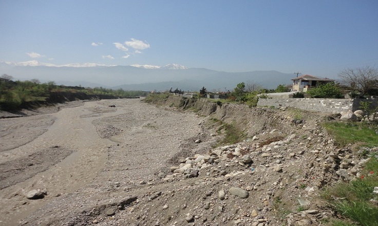
The study area includes the Cheshmeh Kileh River in Tonekabon, with the length of 18.4 km, Azarod in southeast Tonekabon, with the length of 8.65 km, Kazem Rud in Abbas Abad, with the length of 8 km, and Chalkrud in Ramsar with the length of 9.35 km from the point where the rivers exit the forest area to the point where they meet the sea.
The rivers are located in the level 2 basin of the rivers between Haraz and Sefid Rood, which themselves are part of the level 1 basin of the Caspian Sea. According to the divisions approved by the Ministry of Energy, the range of rivers studied in the level 2 basin of the rivers between Haraz and Sefid Rood is located in the Ramsar-Chalus study area with the code 1402.

 CLIENT
Mazandaran Regional Water Company
LOCATIONMazandaran
DATE OF COMPLETION2024